

A Cascade of Waterfalls!
My lovely wife and I just LOVE waterfalls. We go to them regularly. I have a guide book of Waterfalls of Massachusetts by Joseph Bushee Jr., and keep track in the book of which one's we've been to. In our waterfall guidebooks for other states, we also have marked which ones we've visited and have quite a few marked for future visits.
I also bookmark waterfall websites. One good one is Waterfalls of the Northeastern United States. It has hundred and hundreds of waterfalls sorted by state, plus tons of other info about waterfalls. It covers New England and New York, plus Washington, Oregon, Alberta, British Columbia, and one waterfall in California. For global coverage: www.worldwaterfalldatabase.com. Another FUN waterfall site is Waterfalls by Jan & Christy Butler, which includes 360° photos of waterfalls in New England plus a few in New York. None of these excellent sites have ALL the waterfalls, but they are still great resources.
My lovely wife and I always takes lots of pictures of the waterfalls we visit, and I'm constantly adding them to this page. We just think waterfalls are awesome! So, in reverse chronological order, here are some of our photos of waterfalls we've visited:
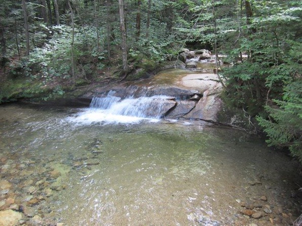
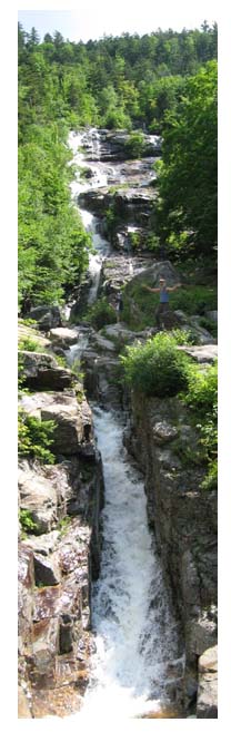
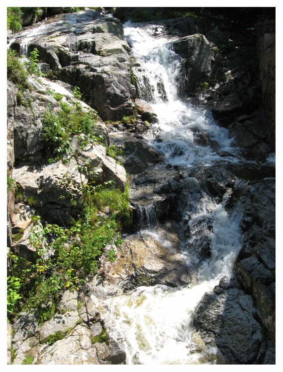
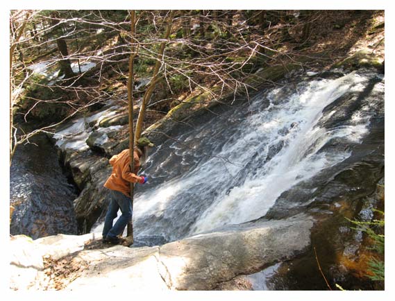
Ripley Falls
.jpg)
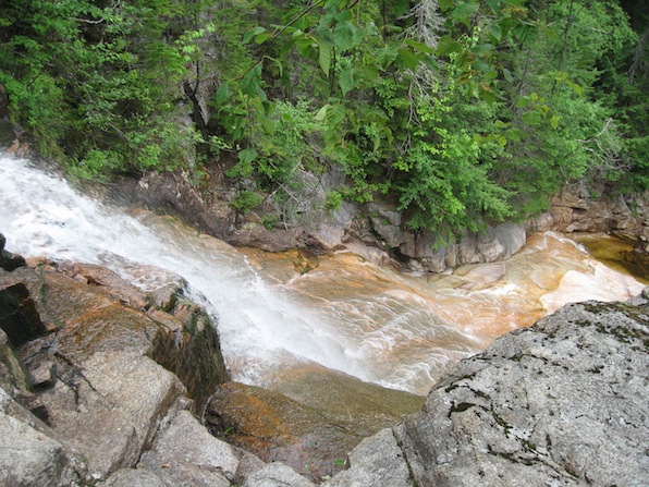
The main falls that you can see from the trail.
The main falls seen from the top.
.jpg)
The falls above the main falls seen from the same location as the photo above.
The view from the top.
Ripley Falls
Crawford Notch State Park
Hart's Location NH
August 10, 2022
The trail in to this falls was a bit difficult. It is full of rocks and scree and roots, quite steep in places and quite wet in others. It took us most of an hour to slowly do the 1/2 mile trail. I'm sure faster hikers could do it in considerably less, but this spectacular falls made it quite worth it the trip no matter how long it took.
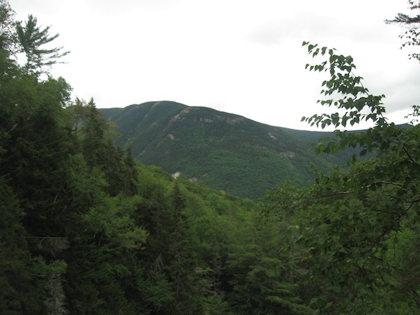
The main falls in the top photo is what most people see. After laboring the length of the trail to get there, most people don't think of going any further. But I like to also see a waterfall from the top (see Silver Cascade below), so I rock hopped across Avalanche Brook and then scrambled up the very steep incline beside the falls and got to the top after about 10 minutes of very careful climbing. I was well rewarded because not only did I get to see the main falls from the top, but I also got to see something most people don't see: the 3 cascades above the main falls and the mountain view from that vantage point! And on the way down, I also found a very narrow trail back down that was very much easier than the way I went up.
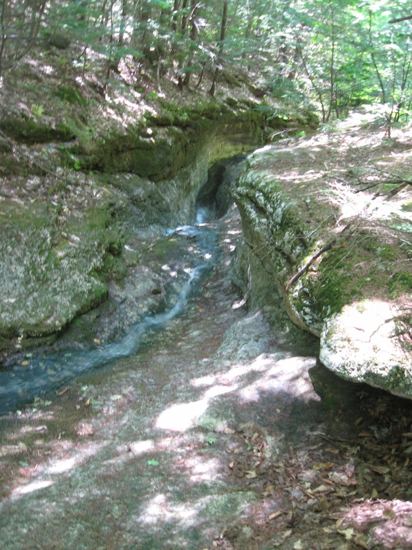
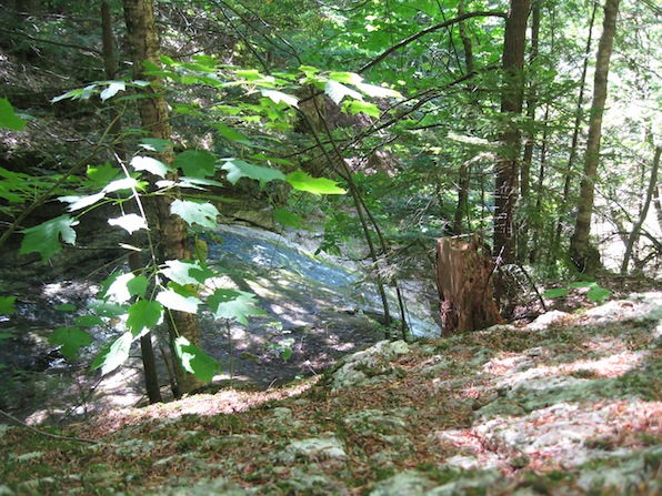
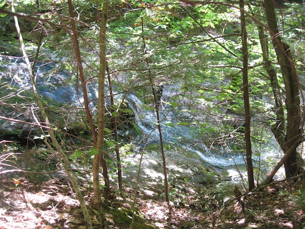
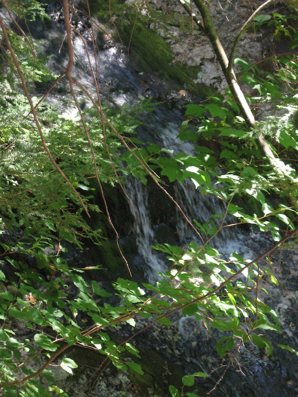
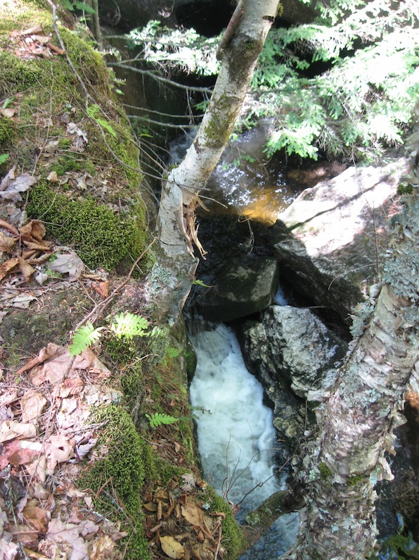
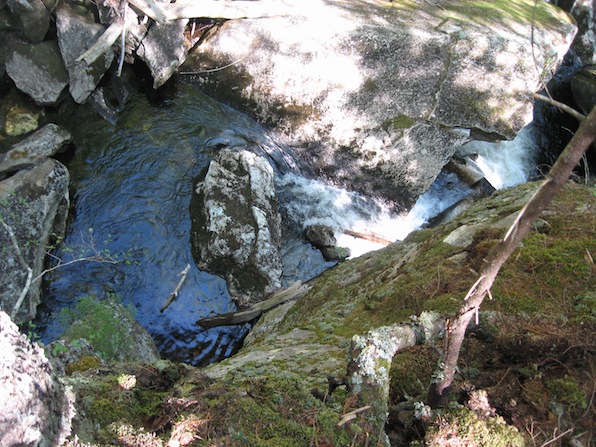
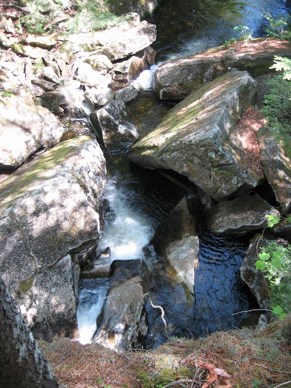
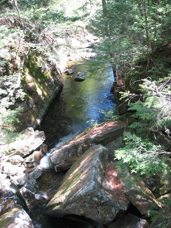
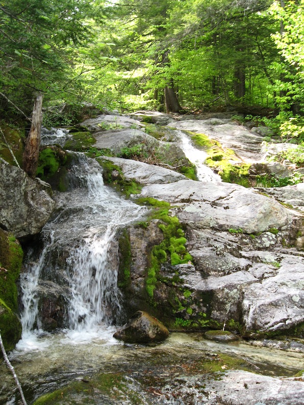
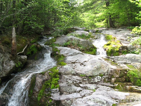
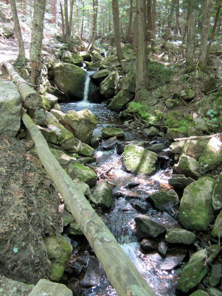
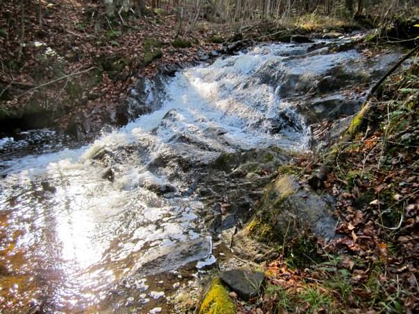
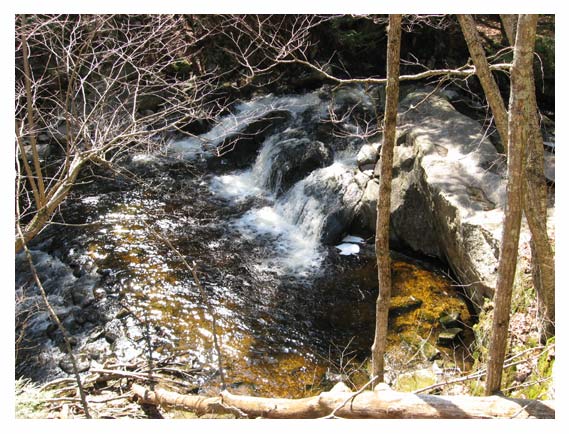
Slade Brook Falls
The lower falls.
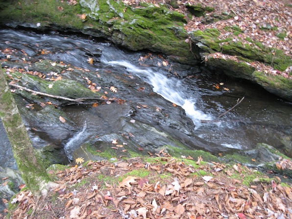
The middle falls.
The upper falls.
Slade Brook Waterfalls
Jim & Evalyn Hornig Natural Area at Lower Slade Brook
Hanover Conservancy
Hanover Conservancy
Hanover NH
October 24, 2020
October 24, 2020
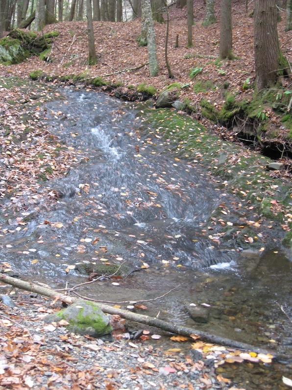
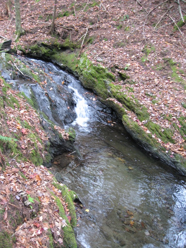
The parking area for this hidden gem would have been very difficult to find had I not looked for it in Street View first. There's no sign, no marker, no nothing except a maybe 6" tall capital "P" on a 2" post next to a pair of ruts into the woods right at the end of a guardrail. Very easy to miss. The waterfalls, however, are delightful, even though we went when the water is low. (Everything we read said the upper falls is pretty spectacular during spring melt and after a storm!) The path — appropriately called the Waterfall Trail — is wide enough to walk 2 or 3 abreast, and is a very easy 1/2 mile in.
The lower falls is a very gently sloped cascade. The middle falls is a shorter but steeper cascade with the heaviest flow up against the southern bank. And the upper falls is tiered falls dropping into an abrupt right angle turn with the water then going through a very narrow trough to a shallow pool.
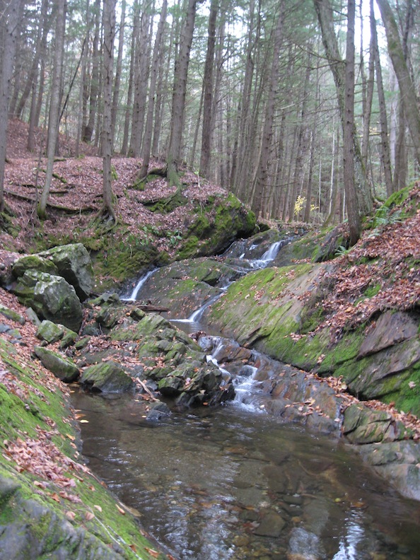
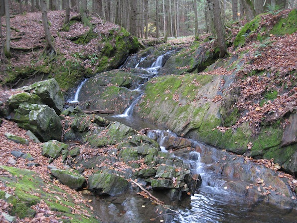
Bickford Slides
Bickford Slides - Lower Slide
White Mountain National Forest
Caribou-Speckled Mountain Wilderness
Stowe ME
September 12, 2020
White Mountain National Forest
Caribou-Speckled Mountain Wilderness
Stowe ME
September 12, 2020
The trail up from Brickett Place to the Bickford Slides is fairly steep and rocky. Some of us weren't really sure we wanted to do it, but we persevered and had a very nice (but fairly tough) hike to the delightful Lower Slide, which is a 50' drop in a series of cascades both through narrow rifts in the rock as well as spilling over wide ledges. These 4 photos show the most easily photographable parts of the upper roughly 2/3 of the falls --- it was just too wet and steep to get down to the bottom to shoot the rest.
Then we headed up the trail to the Upper Slide (which photos show to be a gorgeous 40' drop that fans out the further down it goes), but the trail turned out to be too difficult for us, so we stopped and had bit of a sit-down on a rather large log next to Bickford Brook and enjoyed a light snack with the sounds of the flowing water and the beauty of the deep woods without sight or sound of anything else even vaguely resembling human. Wonderful!
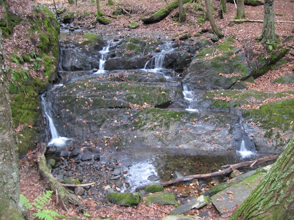
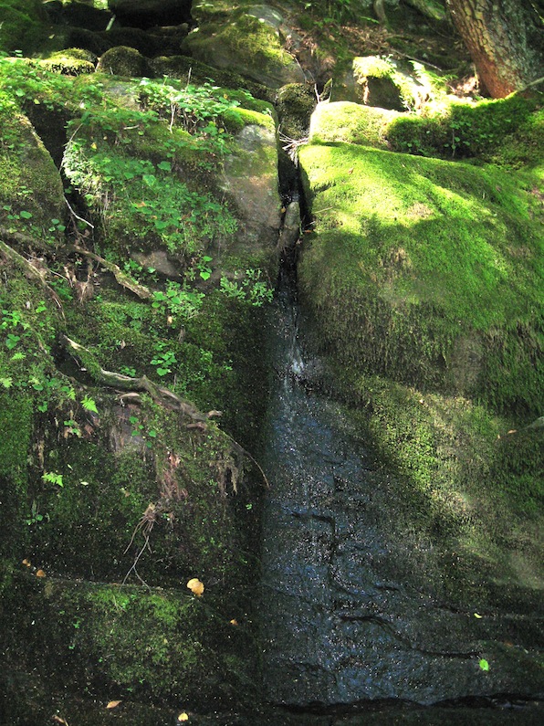
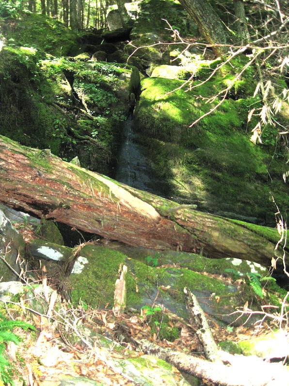
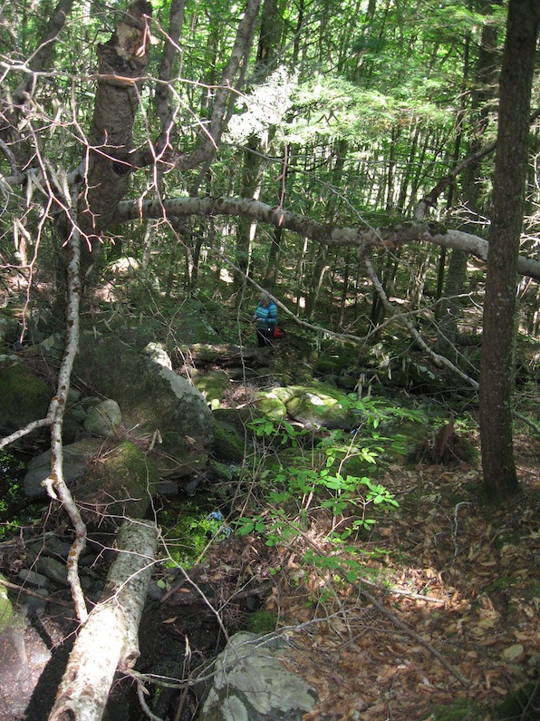
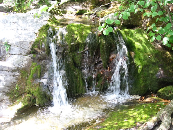
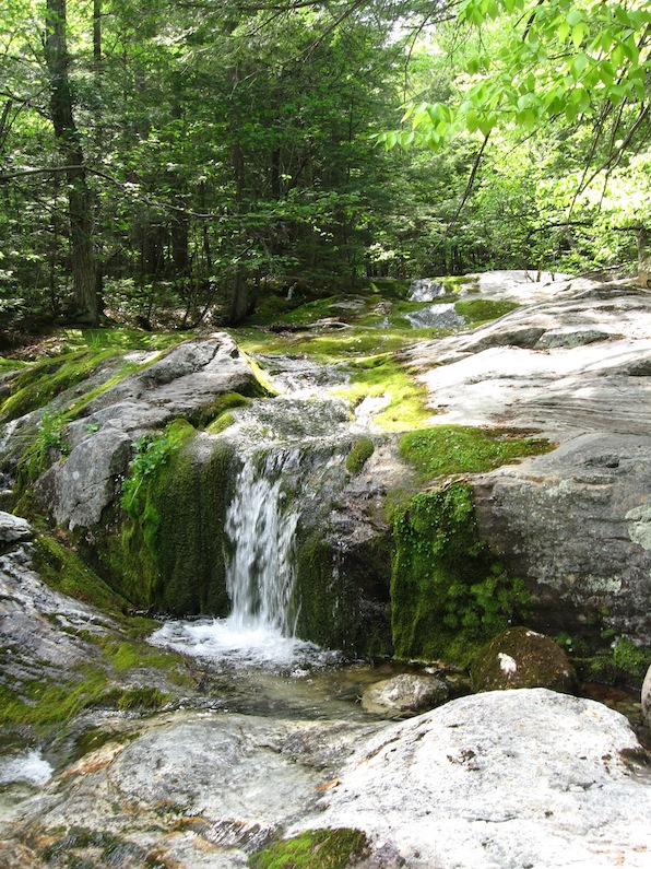
Taproot Commons Farm Waterfall
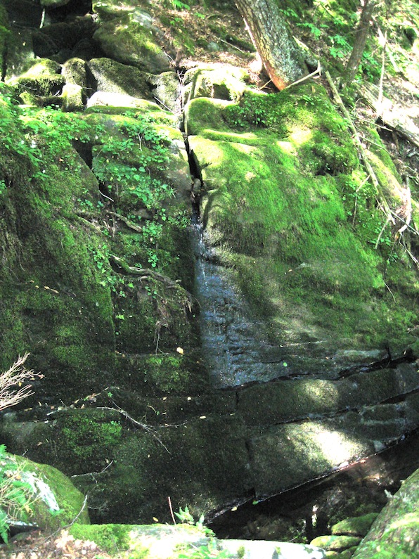
Taproot Commons Farm Waterfall #1
Taproot Commons Farm Waterfall #2
Taproot Commons Farm Waterfall #3
Taproot Commons Farm Waterfall #4
Taproot Commons Farm Waterfall
Hilltowns Land Trust
Cummington MA
September 6, 2020
Hilltowns Land Trust
Cummington MA
September 6, 2020
Since we went in the early Fall, there wasn't much of a flow, but it was very obvious that this waterfall would be roaring in the Spring during snow melt, going the full width of the ledge in the top photo! It was a little hard to find the parking pull off since it wasn't marked, but with the help of someone at Taproot Commons Farm next door, we got there. And kudos to Taproot Commons Farm for allowing visitors access to their property, where both the trail and the waterfall are located. Just the walk through the woods was delightful — which is why I put the bottom photo in, to show you what it's like there. The woods is an unusual assortment of hemlock, red maple, grey birch, and sycamore with an occasional enormous white pine here and there. We had a delightful lunch to the sound of trickling water, while we sat on the big rocks next to the falls.
Mother Walker Falls

Mother Walker Falls #1
Mother Walker Falls #2
Mother Walker Falls #3
Mother Walker Falls #5
Mother Walker Falls #6
Mother Walker Falls #6
Mother Walker Falls
Grafton Notch State Park
North Oxford ME
May 26, 2016
Grafton Notch State Park
North Oxford ME
May 26, 2016
Normally, I wouldn't put so many pictures of a waterfall that is so hard to photograph without obstructions, but most of the photos of it online aren't photos of the actual falls but rather of the stream running over some rocks above the falls. One of those sites even went so far as to say that this waterfall is "not worth visiting." They clearly didn't see the actual falls. If you like waterfalls, it's well worth the short hike in from the parking area, especially since Mother Walker Falls is only 9/10 of a mile from Screw Auger Falls just below on this page.
Mother Walker Falls plunges steeply down through a very narrow gorge. Photo #1 and #2 are of the same tier from above and from the side. The following photos follow this lovely waterfall downstream tier by tier.
Screw Auger Falls

Screw Auger Falls first view
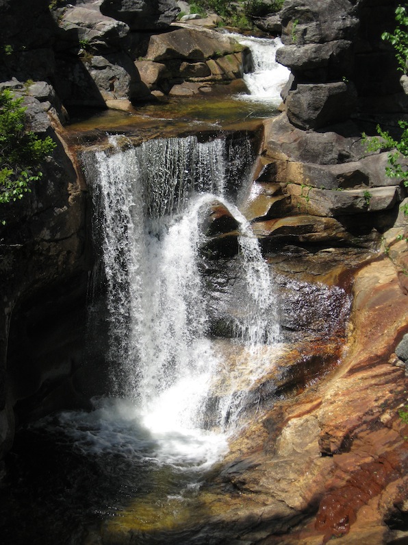
Screw Auger Falls full view
Screw Auger Falls small upper falls
Screw Auger Falls
Grafton Notch State Park
Newry ME
May 26, 2016
Grafton Notch State Park
Newry ME
May 26, 2016
This waterfall has been on our bucket list for most of 20 years, and we finally got to see it! The top photo is what you see when you first approach the falls. You can clamber up onto the rocks above it and get a view looking down, but you certainly can't get a full view of the falls from here. But walking down the very wide trail a ways and and out onto the rocky cliff downstream, you can get a full view. The photo, however, is a close-up shot; the actual view is from much further away. Not to mention that I was hanging onto a small tree and leaning over the edge of the cliff to get this shot. The third photo is the much smaller but still delightful upper falls.
Screw Auger Falls is probably the most famous and most visited waterfall in Maine. It is very close to the parking area, has wide easy to navigate trails, several descriptive information signs, rock ledges for sunbathing, picnic tables, bathrooms, walking trails going both up- and downstream, a nice wading area for families with young children, swimming for the more daring, and a small but impressive natural stone arch.
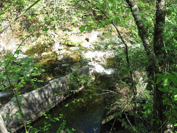
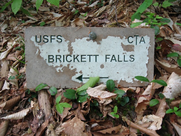
Brickett Falls

May 23, 2016
Brickett Falls
Chatham NH
Brickett Falls
Chatham NH
My lovely wife and I took a week-long vacation at our family's cabin at camp in Maine. While we were there, we used the opportunity to explore several delightful spots that we'd never had time for during the actual camp session. Brickett Falls was one of them.
Although the trailhead was a little hard to find (since the directions in the guidebook were wrong!), it was well worth the effort. After a delightful 1.1 mile uphill hike through a variety of woodlands, we emerged from the trees at the bottom of the series of multiple horsetails and slides that make up Brickett Falls. The trail along the falls allows you to hike up beside it and climb out onto the rocks at each of the small falls. Although the highest drop is only 8', we really enjoyed this outing quite a bit. The photos above going down the page are in the order we saw them: from the bottom of the falls to the top.
Franconia Notch State Park
Franconia Notch State Park #1
Franconia Notch State Park #2
Franconia Notch State Park #3
Franconia Notch State Park #4
Franconia Notch State Park #5
Franconia Notch State Park #6
Franconia Notch State Park #7
unnamed waterfalls
Franconia Notch State Park
Lincoln NH
August 6, 2014
Franconia Notch State Park
Lincoln NH
August 6, 2014
On the walk through the woods along the stream to see The Basin, there's lots of small, unnamed waterfalls. This is just a few of them.
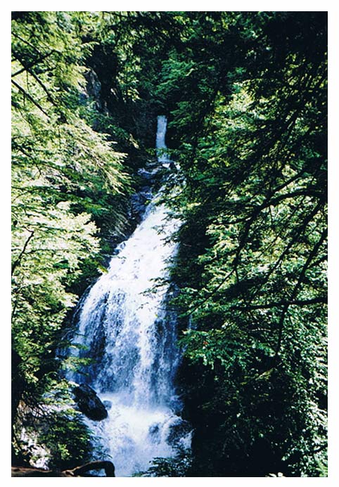
Stevens Glen waterfall

Stevens Glen waterfall
Richmond MA
Richmond MA
April 12, 2014
Thompson Falls
Thompson Falls
Intervale NH
Intervale NH
August 4, 2013
This is the lowest of this 7-tiered, 150' cascading waterfall. The cascades range from 18'-30'. And it's only about a half mile walk from the parking area, too. Well worth the visit.
Sabbaday Falls
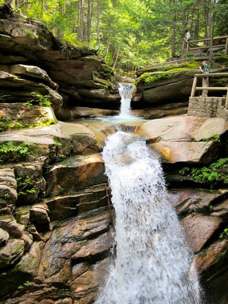
Sabbaday Falls #1
Sabbaday Falls #2
Sabbaday Falls #3
Sabbaday Falls
Kancamagus Scenic Byway
Waterville Valley NH
Kancamagus Scenic Byway
Waterville Valley NH
August 2, 2013
Sabbaday Falls is the most popular waterfall in New Hampshire. On the Kancamagus Highway (locally referred to as "the Kank"), it has ample parking, well-groom wide trails, boardwalk and stairs for easy access and safe viewing, and is simply spectacular!
The three photos above go one right after each other from the top down: the lower falls in #1 is the upper falls in #2, the lower falls in #2 is the upper falls in #3. As you can see in #2, the stream bed takes an abrupt 90° turn. It then flows down in a series of tall cascades through a long narrow gorge, emptying it the bottom into a deep green pool.
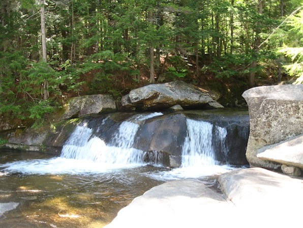
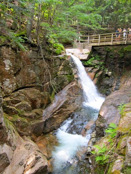
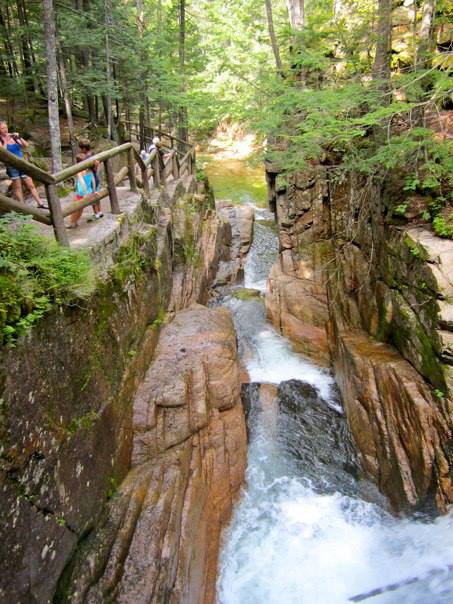
Rocky Gorge waterfall
Rocky Gorge
Kancamagus Scenic Byway
Albany NH
August 2, 2013
Kancamagus Scenic Byway
Albany NH
August 2, 2013
Rocky Gorge is one of my favorite stops on "The Kank" — as the locals call the Kancamagas Highway. The waterfall cascades 15' down into a long, deep, wide cleft in the rocks. When I was a teen, we used to have a blast jumping off the cliffs near the falls, swimming the length of the gorge, and then climbing out again at the low spot in the foreground, and doing it all over again. They've banned swimming in the gorge since then, but it's still a great spot with plenty of parking, swimming upstream, a bridge over the gorge, nice hiking trails, informational signs, and a well-designed viewing area.
Windmill Hill Pinnacle Association
unnamed waterfall
Windmill Hill Pinnacle Association
Windmill Hill Pinnacle Association
Westminster West VT
June 6, 2011
My best buddy's old house is just a few miles from one of the trailheads at Windmill Hill, so when he lived there, we hiked there several times. This narrow 4' waterfall is right next to the trail we used, so we saw it every time.
Twin Cascades
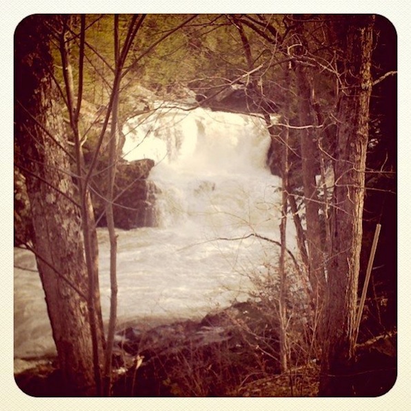
Twin Cascades
Florida MA
Florida MA
April 17, 2011
This waterfall is heavily swollen due to spring snowmelt in the Berkshires of Western Massachusetts. There are two waterfalls here — one a 60' drop and the other 80' — that come together in a Y at the bottom. This photo shows just a very small part of one of them.
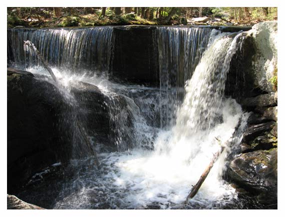
Sutton Falls
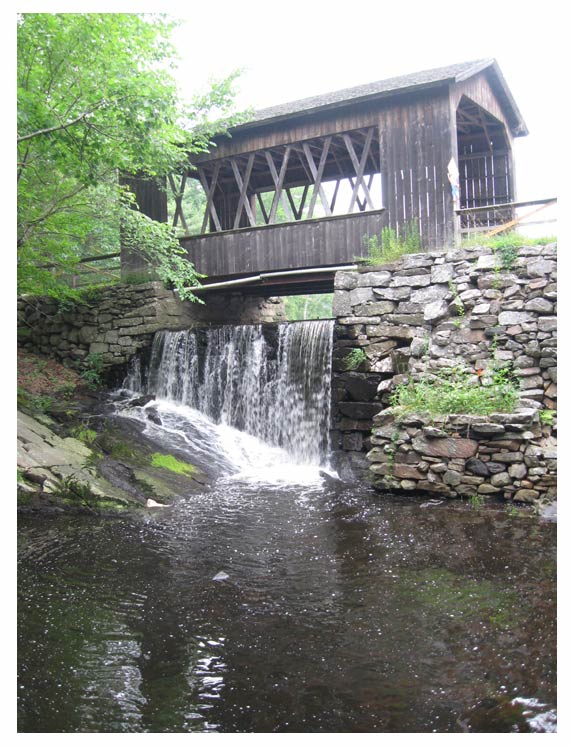
Sutton Falls
Sutton MA
July 29, 2009
A
covered bridge, a stone wall, and a waterfall. Cool. Granted, it's just a spillway, but the fact that it hits that naturally-occurring, angled flat rock, makes it just over the line in my book. Plus, we're
sitting on a wooden park bench beside the stream enjoying the sight and
sound of this little falls.
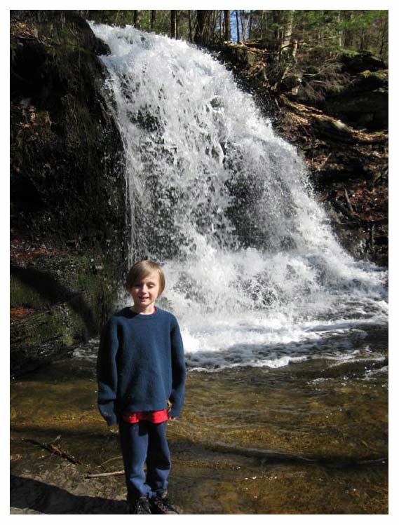
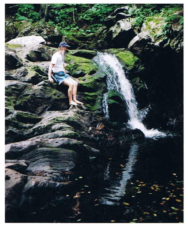
Pete's Waterfall
Pete's Waterfall upper falls
Pete's Waterfall lower falls
Pete's Waterfall
Island Pond VT
Island Pond VT
November 1, 2008
My
brother-in-law Pete has a really cool place up in the Northeast Kingdom
of Vermont. Besides the little house he built himself with plenty of
help from friends and family (and ah helped!), his property also
has a huge sand cliff, a beaver pond, lots of trails that Pete cut
himself, and this really cool series of waterfalls! This view is looking down from
the top of the largest vertical drop.
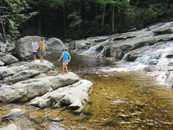
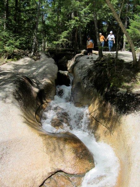
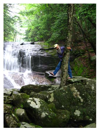
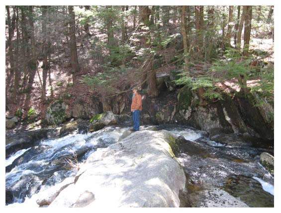
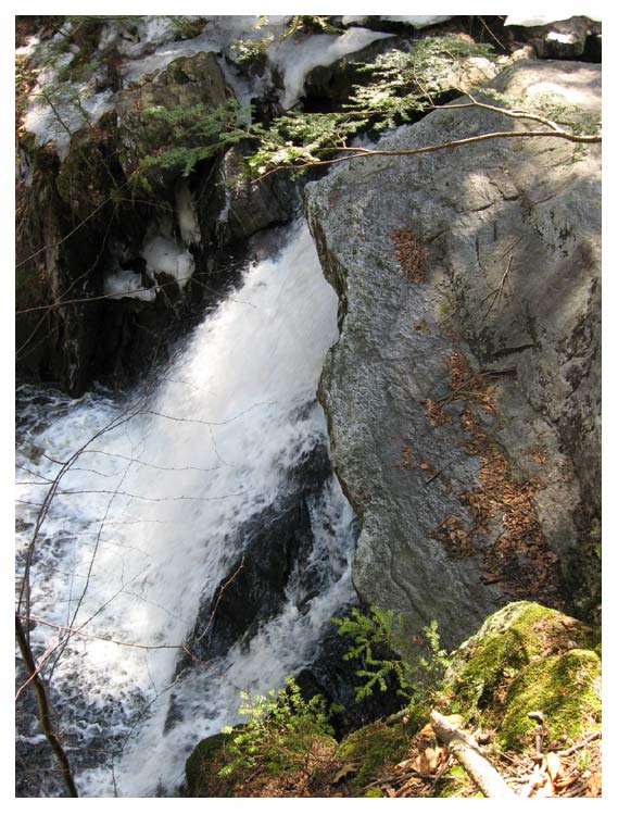
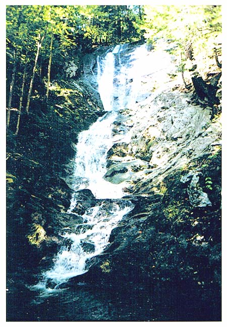
Silver Cascade
Silver Cascade
Crawford Notch State Park
Hart's Location NH
Hart's Location NH
August 13, 2008
This is plain and simple the most amazing waterfall I've ever seen. It's not wide, but it sure is tall! Pictured here is just the part you can see from the highway... and it does comes down right to the edge of the road! Then the brook goes under the highway. There's actually a lot more of it that you can't see from here, it goes on for a long, long, long ways up the mountain. Once when I was a teen, some friends and I spent most of a day climbing the falls and I never did get to the top!*
Even more amazing is that about 100 yards up the road is another tremendous waterfall just like this one: the Flume Cascade. Not quite as much of it is visible from the road, but it's still mighty spectacular! (See the next photo below.)
P.S. Just to give an idea of the scale of Silver Cascade, can you find me in the above picture?
* 5 decades later, I climbed another, much smaller waterfall and easily made it to the top.
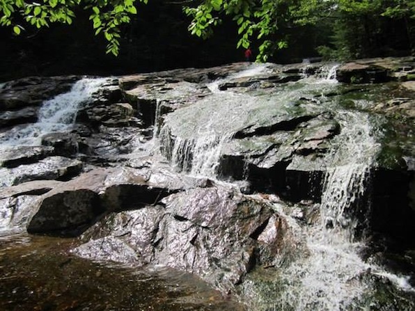
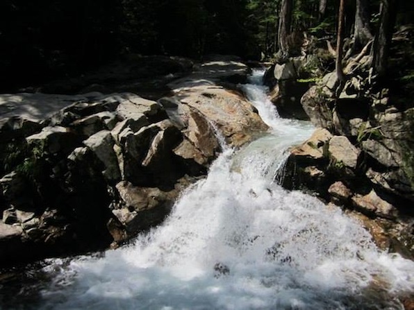
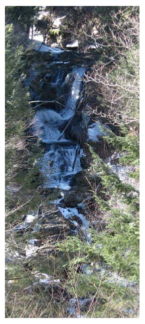
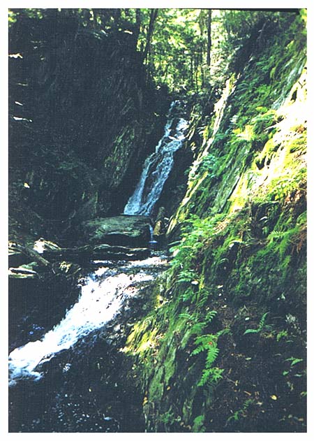
Flume Cascade
Flume Cascade
Crawford Notch State Park
Hart Location NH
Crawford Notch State Park
Hart Location NH
August 13, 2008
Like I said just above at Silver Cascades, Flume Cascades is literally right next to it. You just walk up the road for about 60 seconds and there it is. It's just as big, just as long, and just as awesome as Silver Cascades... there's just not as much of it visible from the road. Actually, you can see a bunch more of it from the road than is in this picture, but this is the picture I've got so it's what you get to see, alright?
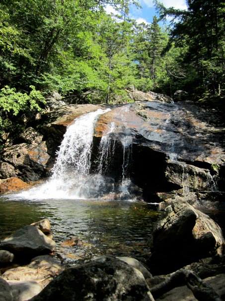
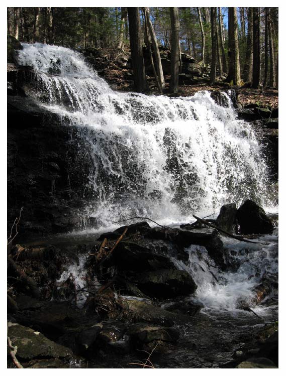
Wahconah Falls
Wahconah Falls
Wahconah Falls State Park
Dalton MA
July 11, 2008
Wahconah Falls State Park
Dalton MA
July 11, 2008
The
whole falls is BIG! Plus, up the trail from here, there's a boodle of smaller falls (click here to see one below) for those who actually take the time to walk.
One of the great things about Wahconah Falls is that it's only 5
minutes from the road! It's 3 minutes from Rte. 9 to the Wahconah Falls
State Park parking lot, and then just a 2 minutes walk down the hill to
the head of the falls.
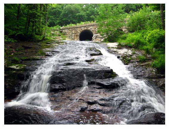
Chapel Brook Falls
Chapel Brook Falls #1
Chapel Brook Falls #2
Chapel Brook Falls #3
Chapel Brook Falls
Ashfield MA
Ashfield MA
June 15, 2008
Chapel
Brook comes gushing down the mountain, goes through a stone tunnel
under the road, and then spills down over the cliffs in a long series of
four major falls and a bunch of smaller ones, too. (Sorry there's no picture of #4.)
There's not really a trail down alongside it, but there isn't much of
any underbrush in the woods so it's fairly easy to make your way down.
Up
above on the other side of the road is a really nice trail that winds
around and up the mountain, past some pretty neat cliffs (that have
climbers on them regularly), and eventually ends at a fabulous view
looking down over Ashfield.
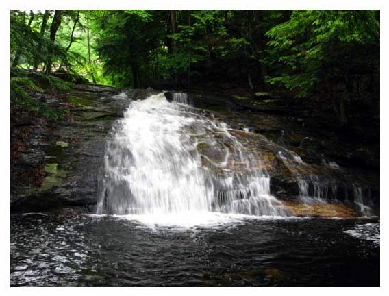
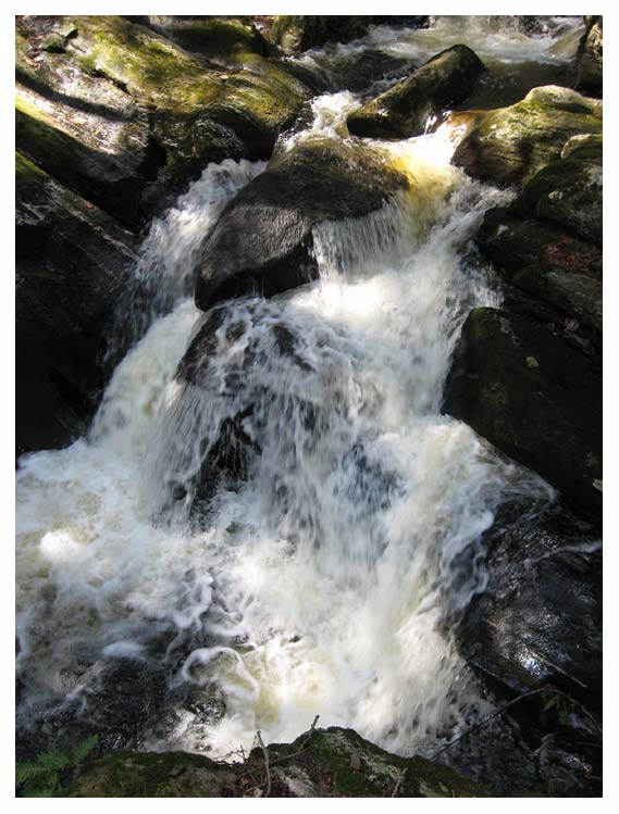
Gunn Brook Falls
Gunn Brook Upper Falls #2
Gunn Brook Upper Falls
Sunderland MA
April 7, 2008
Gunn
Brook Upper Falls --- and the middle and lower falls, too --- is off of
(appropriately enough) Falls Rd on a steep little dirt road called
(also quite appropriately) Gunn Cross Rd, in Sunderland MA. I don't
remember ever seeing anyone else on this road even though I've been to
this delightful falls quite a few times --- it's only about 15 or 20
minutes from our house. Most of the year, Gunn Brook Upper Falls is just
a whole bunch of trickles spread out about 10'-20' wide going down over
a couple of 15' drops. Even then, it's still pretty cool and very
gorgeous. But this particular visit, we purposely went during spring
thaw and the water was just THUNDERING down in a torrent! It was
awesome!
The upper part of this part of the falls has a bit of an undercut in the cliff behind it. You can almost
get behind it without getting wet. It comes down into a large, shallow
pool that's probably about 20' square. That's our friend and former
housemate Rowan standing next to the edge of the pool. The lower part of
the falls flows directly out of that pool in a series of step cascades
before the brook meanders along it's merry way to the Middle and Lower
falls.
Enders Falls
(Sorry
this video is in the wrong place. It actually belongs up one tier below
#5, but I mislabeled it as #6 when I first put it on YouTube, so when I
downloaded it to here I put it in the wrong place. And evidently moving
it is beyond my admittedly limited tech abilities right now. So it's
going to stay out of place here until I figure it out how to move it. Oh
well.)
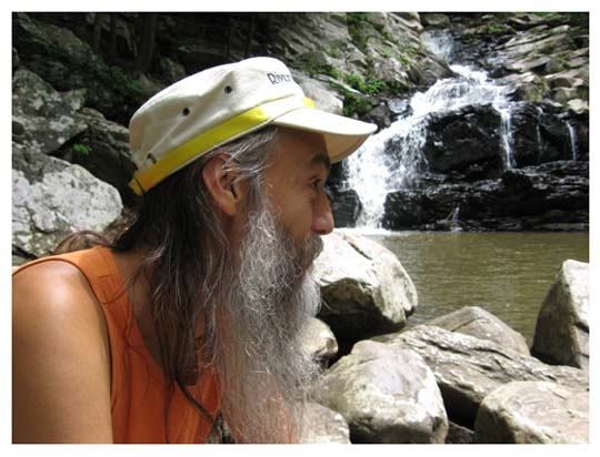
Enders Falls
Enders State Forest
Enders State Forest
Granby CT
April 3, 2008
Enders
Falls is actually a long series of small falls of all different sizes
and types. There are six main sets of falls with lots of smaller falls
in between, and every one of them is a delight! The six photos above are
in order as you walk down beside the falls from the top down. We sat on
a big flat rock on the right side of #5 and ate our lunch while we
watched the falls and listened to the sound of the falling water. Ah
bliss!
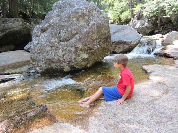
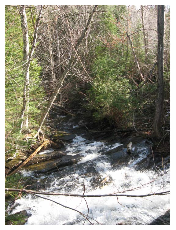
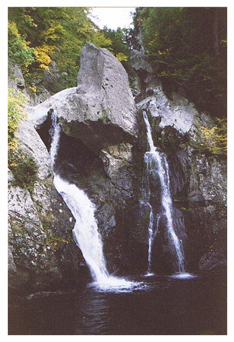
Sanderson Brook Falls
Sanderson Brook Falls
Chester MA
March 17, 2008
When my lovely wife and left our home in the valley to go visit Sanderson Brook Falls one day in the middle of March, it was in the mid-50's at our house. But an hour later when we got to the hilltown of Chester MA, it was in the lower 30's, and the trail was completely covered with at least a foot of snow! (You can see snow through the trees on either side of the falls.) Fortunately, we had plenty of warm clothing with us and the trail was an easy hike. Unfortunately, when we got to the falls, the access trail down to it was very steep, very narrow, very icy, and there was absolutely no way we could possible get down it without ending up in the water. So this is a long-distance photo from the main trail. We're planning on going back to this one, but later in the Spring next time.
Ross Brook Falls
September 4, 2006
Ross Brook Falls (above)
& Tannery Brook Falls (below)
& Tannery Brook Falls (below)
Savoy MA
After
driving on some really binky roads, ending with most of a mile on a
beat-up dirt road, you park in this little tiny parking area. From
there, you plunge into the woods. And I do mean "plunge" because the
trail almost immediately starts down steeper and steeper. Several sets
of stairs make the descent a bit easier at the more difficult places.
But when you step off the final stair at the bottom, you see why you've
been able to hear the falls almost all the way down: to your left is the
amazing Ross Brook Falls (pictured above) and to your right is the equally amazing Tannery Brook Falls (pictured below). It's a twofer!
Tannery Brook Falls
(see above photo for info on this one)
Wahconah Falls
 one of the many, many smaller falls above the main part of Wahconah Falls
Wahconah Falls State Park
Dalton MA
September 3, 2005
Hudson Brook Chasm Falls
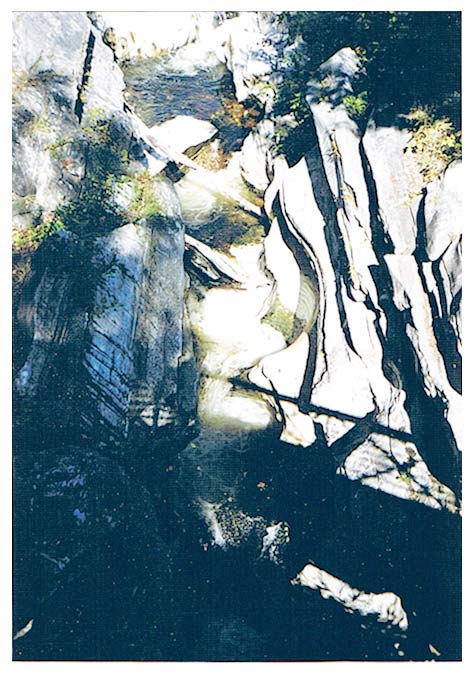
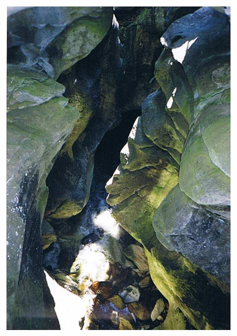
Hudson Brook Chasm Falls
Natural Bridge State Park
North Adams MA
September 19, 1999 (I think)
Natural Bridge State Park
North Adams MA
September 19, 1999 (I think)
Niagara Falls
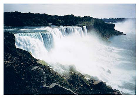
Niagara Falls
Niagara Falls NY
Niagara Falls NY
August 23, 1999
In
August of 1999, on the way home from my brother-in-law's wedding in
Almont Michigan, we stopped to see America's most famous waterfall. From
Michigan to Massachusetts, it's a straight shot across Ontario's
southern peninsula to Niagara Falls, and straight across New York State
to Massachusetts. So since we were going through the town of Niagara
Falls NY on the way home from the wedding, we stopped to see this
absolutely stunning waterfall! Wow! We were able to get pretty close,
but I was a bit bummed when I discovered that that stairway to the
viewing station at the bottom of the picture was closed to the public.
*sigh* But it's still an amazing sight no matter where you view it
from!
Bash Bish Falls
1998 sometime
Bash Bish Falls
Mount Washington State Forest
Mount Washington MA
Bash Bish Falls
Mount Washington State Forest
Mount Washington MA
Don't
let your eyes fool you, this thing is HUGE! Those twin falls coming
around that "spur" of rock up there are over 50' tall! Plus there's
another 40' of cascades up above it that didn't make it into the
picture! Situated on the New York border in the southwest corner of
Massachusetts, Bash Bish Falls is billed as the state's "most
spectacular falls". I've been to a mighty lot of waterfalls in the
state, and so far I've got to agree. This falls is simply SPECTACULAR!
Plus, it's less than 15 minutes from the parking lot on a fairly easy
trail that has stairs on the really steep parts. Highly recommended.
Lost River Gorge
Lost River Gorge
Woodstock, New Hampshire
August 1967
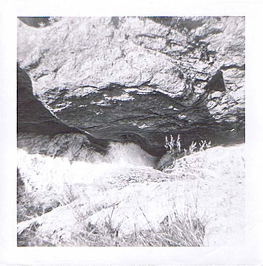
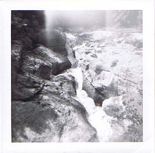
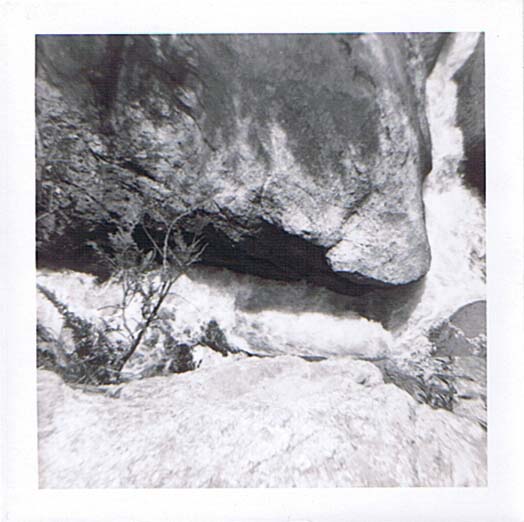
I recently unearthed both the prints and the negatives of my first three rolls of film ever! I took these pictures when I was 11 years old way back in 1967! I made an exhibit of them in my virtual art museum. (Click here to see the whole thing.) Lost River is a pretty amazing natural phenomena. Over about 3/4 of a mile, the river drops hundreds of feet through a deep rocky gorge. The river is often out of sight underground -- hence the "Lost" part -- and you have to climb down various ladders from the boardwalk into subterranean caves to see all of it! It's awesome! I love this place. This is just three of the smaller falls there.
UNKNOWN
The waterfalls below, I know I've visited because I have the photos, but either the waterfall itself or the date of the visit is unknown.
Moss Glen Falls
Moss Glen Falls
Stowe VT
(date unknown as yet)
(but it's in my records somewhere so it will appear here eventually)
Special thanks to Dean Goss at Waterfalls of the Northeast United States
for identifying this one for me. It's still languishing in the Unknowns here at
the bottom of the page because I haven't taken the time to date it yet.

unknown waterfall
(I'll post the info here as soon as I figure out what falls this is. If you have any idea, please email me. Thanks)
TREVOR'S QUALITY GUARANTEE:
YOU WILL BE 100% SATISFIED AND
YOUR GROUP WILL HAVE A WHOLE LOT OF FUN...
OR IT'S FREE!
YOU WILL BE 100% SATISFIED AND
YOUR GROUP WILL HAVE A WHOLE LOT OF FUN...
OR IT'S FREE!
413-247-3322
trevor@trevorthegamesman.com
PO Box 463, Haydenville, MA 01039